
Fall color in the mountains around Asheville doesn’t arrive all at once. It starts on the highest peaks in late September or early October and works its way downhill for six weeks, which means the best fall hikes near Asheville depend as much on timing as on the trail itself. Show up at a 6,000-foot summit in late October and you may find bare branches. Visit a low river trail in late September and everything’s still green.
The trick is matching your elevation to the week you’re hiking. This guide covers seven trails within about 90 minutes of downtown, plus a bonus roadside waterfall, sorted from highest and earliest to lowest and latest. Whether you’re catching the first cold snap of the season or the last warm week of October, one of these is hitting its peak.
Craggy Pinnacle Trail: Big Views for a Short Climb North of Asheville
If you want the most reward for the least effort, start here. Craggy Pinnacle sits at 5,892 feet, making it the highest trail on this list and one of the first to turn each fall. The hike is only about 1.4 miles round trip, climbing a couple hundred feet through a tunnel of twisted rhododendron and gnarled, wind-stunted trees before opening onto a 360-degree view of the Blue Ridge and Black Mountains.
Because it’s so high, this is an early-season pick. Aim for late September through the first week or two of October, when the surrounding ridges start to color while downtown is still green. The trail reopened in September 2025 after storm repairs, and it’s a favorite for sunrise and golden hour, when mist settles into the valleys below.
The details: Blue Ridge Parkway, Milepost 364.1, roughly 40 minutes north of downtown. Moderate but short. Free parking at the trailhead. Dogs welcome on a leash. Note that this stretch of the Parkway closes in winter and after ice, so it’s a fair-weather hike.
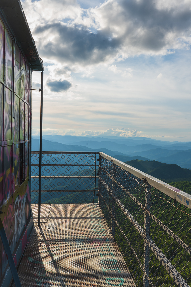
Fryingpan Mountain Lookout Tower: A Fire Tower Hike South of Asheville
Head the other direction on the Parkway, and you’ll find the tallest fire tower in Western North Carolina. Where Craggy Pinnacle gives you a summit and a rock wall, Fryingpan gives you 70 feet of steel steps and a payoff that’s worth the climb, if you’re not afraid of heights.
The hike itself is easy: about 1.5 miles round trip up an old gravel service road, gaining a few hundred feet at a gentle grade. The real view comes from the tower, where you can see Looking Glass Rock to the south, Cold Mountain to the north, and the Shining Rock Wilderness beyond. At 5,340 feet, this is another early-October trail, coloring up around the same window as Craggy.
It also pairs neatly with the next hike on this list, since both sit along the same drive south past the Pisgah Inn.
The details: Blue Ridge Parkway, Milepost 409.6, about 45 minutes south of downtown. Easy grade, but the tower climb is exposed. Free roadside parking near the gate (don’t block it). Dogs welcome on a leash. Closed-in sections apply in winter.
Graveyard Fields: Waterfalls and Early Color Off the Blue Ridge Parkway
A few miles farther south, Graveyard Fields is a different kind of high-elevation hike. Instead of a summit, you get a mile-high valley of open meadow, wild blueberry, and two waterfalls, ringed by 6,000-foot peaks. The odd name comes from old tree stumps that once dotted the cleared valley floor, not anything grimmer.
This is one of the first places near Asheville to peak, often in the first week of October, when the blueberry fields turn deep red and the surrounding ridges follow. The loop runs about 3.2 miles with two waterfall spurs, and the terrain is easy to moderate, with boardwalks over the wettest stretches. It’s genuinely family-friendly, and the parking lot fills early on fall weekends for exactly that reason.
The details: Blue Ridge Parkway, Milepost 418.8, roughly 35 minutes south of downtown. Easy to moderate loop. Free parking, but arrive before mid-morning in October. Dogs welcome on a leash. Restrooms on site, which is rare for a Parkway trailhead.
Strawberry Gap Trail: A Strenuous Climb to Blue Ridge Pastures
Now the elevation starts to drop, and the calendar shifts with it. Strawberry Gap tops out around 4,000 feet, so it colors a week or two behind the Parkway summits, landing squarely in mid-October. It’s also the hardest hike here, which is part of the appeal if you’ve got the legs for it.
The trail climbs steadily from a parking area near Gerton, gaining about 1,450 feet round trip over roughly five to six miles. Halfway up, a rock outcrop at Ferguson Peak gives you a westward view back toward Fairview and Asheville. Push to the top and you reach the grassy summit of Blue Ridge Pastures, looking out over the Hickory Nut Gorge and distant ranges. The trail is maintained by Conserving Carolina and crosses private conservation land, which comes with one important rule.
One caveat worth knowing before you go: dogs are not allowed on this trail. If you’re hiking with a pup, pick one of the dog-friendly options on this list instead.
The details: Trailhead on US-74A near Gerton, about 30 minutes east of downtown. Strenuous, five to six miles round trip. No dogs. Free parking, though the lot fills on clear weekends.
Looking Glass Rock Trail: A Granite Dome Climb Near Brevard
Staying in the same difficulty range but trading open pasture for bare granite, Looking Glass Rock is the other big climb on this list. You’ve probably seen its white stone face from the Blue Ridge Parkway, a curved dome rising to nearly 4,000 feet that looks impossible to hike. Drive around to the back side near Brevard, though, and a switchbacking trail carries you all the way to the top.
It’s a workout: about 6.5 miles round trip with roughly 1,700 feet of gain, climbing almost continuously through rhododendron thickets and a couple dozen switchbacks. The reward is a granite summit with long views back toward Pisgah, Mount Pisgah, and the high peaks around Graveyard Fields. At just under 3,970 feet, it colors in mid-October, right alongside Strawberry Gap and Rich Mountain.
Here’s the payoff for planners: the trailhead sits on the same road as Looking Glass Falls, the roadside waterfall of the same name. Do the climb in the morning, then reward yourself with the two-minute walk to the falls on the way home (more on that below).
The details: Trailhead off FS-475 near the Pisgah Center for Wildlife Education, about 45 minutes southwest of downtown via US-276. Strenuous, roughly 6.5 miles round trip. Dogs welcome on a leash. Small parking lot, no facilities, and it fills early on fall weekends.
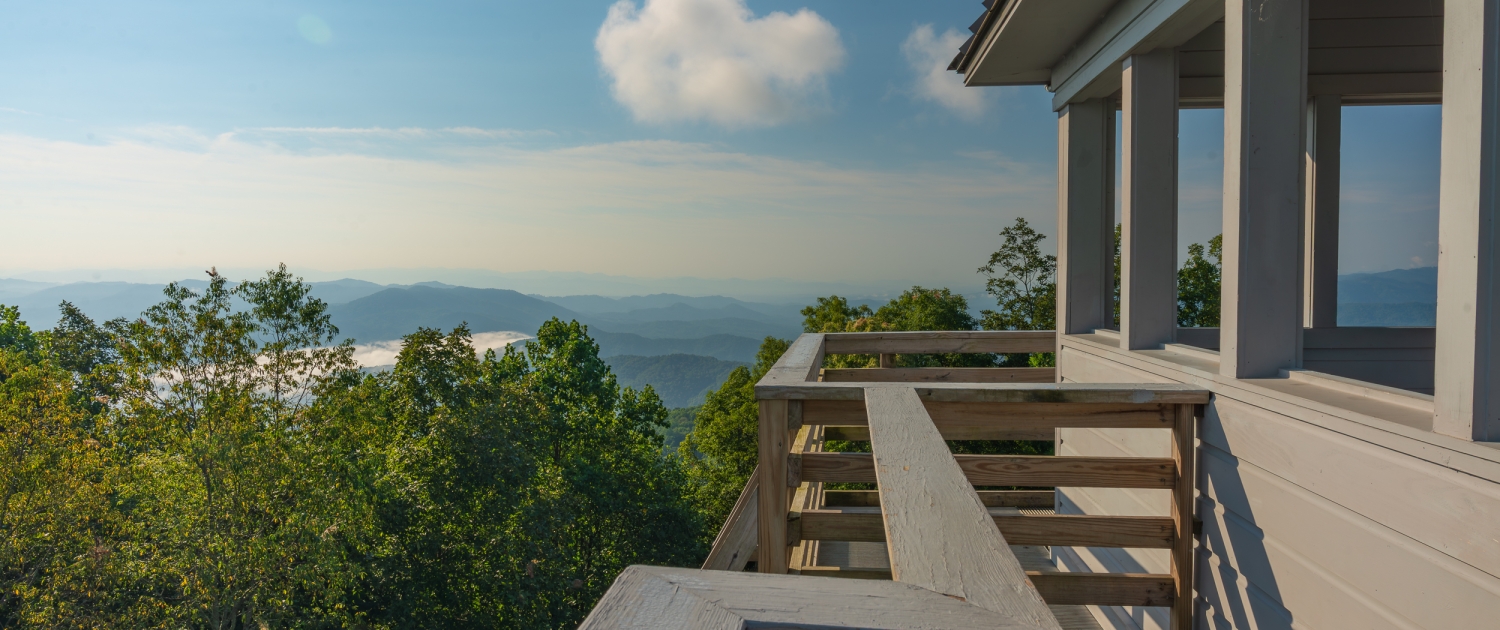
Rich Mountain Fire Tower: Panoramic Views Near Hot Springs
From the granite of Brevard, swing northwest toward Hot Springs for the second fire tower on this list. Rich Mountain sits at 3,643 feet, a solid mid-elevation trail that hits its color around mid-October, right alongside Strawberry Gap and Looking Glass Rock. Where Strawberry Gap makes you work for a pasture view, Rich Mountain trades effort for a restored 1930s lookout tower and a 360-degree panorama.
From the tower you can see across the North Carolina and Tennessee line, with the Great Smokies to the south, Hot Springs down in the French Broad valley, and the Black Mountains to the east on a clear day. The most common route climbs the Appalachian Trail from Tanyard Gap, a moderate few miles up to the spur trail and tower. Fall air tends to be the clearest of the year, which makes the long-range views especially worth the drive.
Combine it with a soak in Hot Springs afterward and you’ve got a full day.
The details: Trailhead at Tanyard Gap off US-25/70, about 45 minutes northwest of downtown. Moderate. Dogs welcome on a leash. Free parking. The tower is also reachable by a short gravel road if you’d rather skip the climb.
Bonus Roadside Stop: Looking Glass Falls Near Brevard
Not every fall outing needs a summit push. Looking Glass Falls is the easiest stop here, a 60-foot waterfall you can see from the road, with a short staircase down to a viewing platform at the base. It’s one of the few genuinely accessible waterfall views in the area, which makes it a good pick for anyone traveling with small kids, grandparents, or mobility considerations.
At around 2,400 feet in the Pisgah National Forest near Brevard, the color here runs later, generally mid to late October, when the higher trails have already turned. The falls run year-round and look their best in the softer afternoon light or on an overcast day. It sits on the same road as the Looking Glass Rock trailhead, so it’s the perfect low-effort reward after that climb, or a stop on its own if you’d rather skip the summit.
The details: US-276 in Pisgah National Forest, about 45 minutes southwest of downtown via NC-280. Roadside viewing plus a short staircase; under a quarter mile total. Dogs welcome on a leash. Free parking is limited and fills fast on weekends.
Laurel River Trail: An Easy Riverside Walk Near Marshall
The lowest and latest hike on this list follows Big Laurel Creek downstream to the French Broad River. At roughly 1,400 feet, the Laurel River Trail holds its color the longest, often into early November, well after the Parkway summits have gone bare. It’s the trail to save for the tail end of the season.
The path follows an old railroad bed, so it stays mostly flat and easy the whole way, with rapids, trout pools, and rock ledges perfect for a picnic. You can hike as far as you like and turn back whenever; the full route to the French Broad runs about 3.6 miles one way. The first stretch crosses private land, so stay on the trail through that section. This is a mellow, family- and dog-friendly walk, the kind you do at a wandering pace rather than a summit pace.
The details: Trailhead off Route 25/70 near Marshall, about 40 minutes northwest of downtown. Easy and mostly flat. Dogs welcome on a leash. Free roadside parking that fills on nice days.
Planning Your Fall Hikes Near Asheville
A few practical notes to make the most of the season.
Timing is everything. Match your elevation to the week: high trails like Craggy Pinnacle and Fryingpan in late September and early October, mid-elevation trails like Strawberry Gap, Looking Glass Rock, and Rich Mountain around mid-October, and lower trails like Looking Glass Falls and Laurel River in late October into early November.
Check road conditions before you go. Several of these trails sit on the Blue Ridge Parkway, which closes sections in winter and after ice or snow, and recovery work from past storms can still affect access. A quick look at the National Park Service road status page the morning of your hike saves a wasted drive.
Go early and dress in layers. Parking lots at the popular spots fill by mid-morning on fall weekends. Temperatures at 5,000-plus feet can run 15 to 20 degrees colder than downtown, so bring more than you think you need. And if you’re hiking with a dog, keep them leashed, pack out what they leave, and remember that Strawberry Gap is the one trail here where dogs aren’t allowed.

Make River Row Your Starting Point
Every one of these trails is a short drive from the River Arts District, which makes River Row Suites an easy launch pad for a fall hiking weekend. You’re about 1.5 miles from downtown, with a full kitchen for packing trail lunches and coffee before an early start, and free parking on site, something most downtown Asheville hotels can’t offer. Our select pet-friendly suites mean the dog can come along for the dog-friendly trails, too.
Frequently Asked Questions
Q: When do fall colors peak near Asheville?
A: There’s no single peak date, because color moves down the mountains over about six weeks. The highest elevations, above 5,000 feet, usually turn in late September and early October. Mid-elevations peak around mid-October, and lower elevations, including downtown Asheville, reach their best in late October into early November.
Q: What are the best easy fall hikes near Asheville?
A: For low-effort fall color, try Looking Glass Falls, a roadside waterfall near Brevard with a short staircase to the base, or the Laurel River Trail near Marshall, a flat riverside walk on an old railroad bed. Graveyard Fields and Fryingpan Mountain Lookout Tower are also relatively easy for the high-elevation views they deliver.
Q: Can you bring dogs on fall hikes near Asheville?
A: Most trails near Asheville allow leashed dogs, including Craggy Pinnacle, Fryingpan, Graveyard Fields, Looking Glass Rock, Rich Mountain, Looking Glass Falls, and the Laurel River Trail. The main exception on this list is Strawberry Gap, which crosses private conservation land where dogs are not permitted.
Q: How far are these trails from downtown Asheville?
A: All seven are within about 90 minutes of downtown. The closest, Strawberry Gap, is around 30 minutes east, while most of the Parkway trails and the Hot Springs–area hikes fall in the 35-to-45-minute range.

 Momento Mori Photography